I visited an awesome beach few months back along with my friends. Since my friends were driving the car, I did not bother to check out the roads and directions. In any case, I am pathetic in remembering roads and directions.
A few days back I thought of again visiting the beach along with my family- sans my friends. The only problem, I do not know how to reach the place. I call up my friends and they try to explain me the way I should take to reach the place.
“Take a left from xyz roundabout”, “Keep on right, look for an exit”, “Keep right, enter some other area…”
At the end, it was all a blabber to me, so I asked them the name of the place. My thought was that I would look it up in my Garmin GPS device or Google maps on my mobile. The names my friends provided returned zero results on Google map.
Dejected, I returned that day.
But I had made a promise to my family to take them to that awesome beach and I had to find the way.
This is how I achieved it.
How to find GPS coordinates from Photos
- Thanks to the awesome mobile phones and their awesome mobile cameras, we click a number of pictures wherever we go.
- Thanks to the snooping and intrusive technology, our mobile phones track the places we visit.
- I opened the pictures I clicked during my last visit a few months back to the beach.
Now this is what I did:
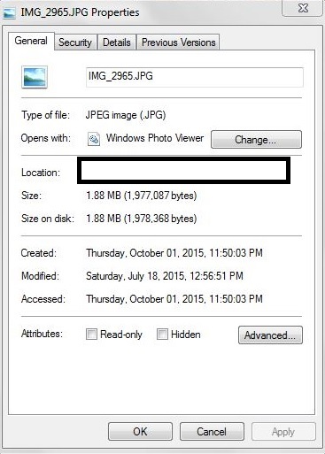
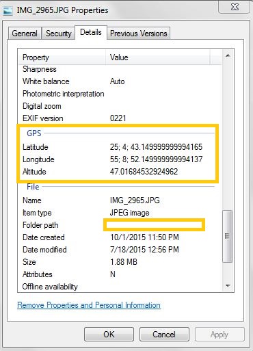
- Right click on the image, Select Properties.
- Navigate to the ‘Details’ tab.
- Scroll down to the ‘GPS’ section.
- There I found the latitude and longitude for the place. It was in HH; MM; SS format.
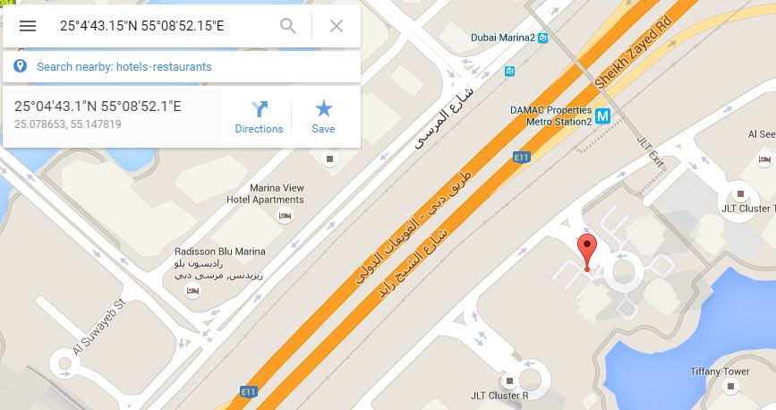
- To search the place in Google Maps, I directly entered the latitude and longitude.
- In my GPS device, I entered the coordinates, saved it to Favorites and set it as a new destination.
And here is the original picture of the beach (Not clicked by me).
P.S: Please be very careful about the minutes and seconds you enter in your GPS. We are talking about the latitude and longitude of our beloved earth over here. I once entered the seconds part incorrectly and it took me to a different block… 🙂


